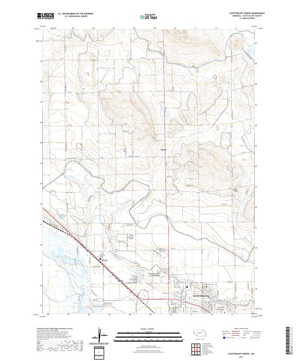
2021 Map of Scottsbluff North
USGS Topo · Published 2021About this map
The North Platte River flows through the southern portion of this region, shaping a landscape defined by an intricate network of irrigation and drainage. North of the river, the city of Scottsbluff expands toward the foothills, anchored by significant educational and research institutions like the University of Nebraska Panhandle Research and Extension Center and the Chadron State College WNCC Campus. The surrounding agricultural lands are crisscrossed by a dense system of canals including the Interstate Canal, Tri-State Canal, and Enterprise Canal, reflecting the area's deep reliance on water management for Nebraska farming.
Find a feature on this map
88 named features on this map. Tap any name to fly to it.
Don’t see what you’re looking for? This feature index may not catch every label — zoom into the map to look around manually.
Map Details
Editions of this 2021 Scottsbluff North Map
This is the sole edition of this map. No revisions or reprints were ever made.
Other maps of this area

1898 · Scotts Bluff
USGS Topo · 1:125,000

1899 · Whistle Creek
USGS Topo · 1:125,000

1954 · Scottsbluff
USGS Topo · 1:250,000

1955 · Alliance
USGS Topo · 1:250,000

1957 · Alliance
USGS Topo · 1:250,000

1958 · Alliance
USGS Topo · 1:250,000

1958 · Scottsbluff
USGS Topo · 1:250,000

1963 · Scottsbluff South
USGS Topo · 1:24,000

1963 · Mitchell
USGS Topo · 1:24,000

1963 · Scottsbluff North
USGS Topo · 1:24,000