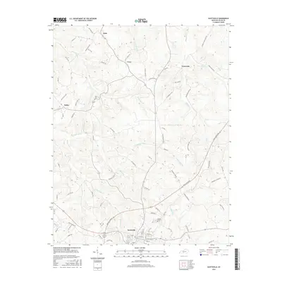
2016 Map of Scottsville
USGS Topo · Published 2016About this map
Scottsville serves as the focal point of this Allen County landscape, where the street grid of the county seat transitions into a network of rural roads following the ridges and creek valleys. The topography is defined by the winding paths of Bays Fork and Difficult Cr, which shape the local transit routes and settlement patterns. Local history is preserved in the placement of sites like Crescent Hill Cemetery and Tabor Cemetery, alongside smaller communities such as Halifax, Settle, and Yesse.
Find a feature on this map
78 named features on this map. Tap any name to fly to it.
Don’t see what you’re looking for? This feature index may not catch every label — zoom into the map to look around manually.
Map Details
Editions of this 2016 Scottsville Map
This is the sole edition of this map. No revisions or reprints were ever made.
Other maps of this area

1921 · Bowling Green
USGS Topo · 1:62,500

1923 · Bowling Green
USGS Topo · 1:62,500

1926 · Scottsville
USGS Topo · 1:62,500

1928 · Adolphus
USGS Topo · 1:48,000

1931 · Lafayette
USGS Topo · 1:62,500

1931 · Adolphus
USGS Topo · 1:62,500

1942 · Gallatin
USGS Topo · 1:100,000

1954 · Austin
USGS Topo · 1:24,000

1954 · Petroleum
USGS Topo · 1:24,000
1954 · Polkville
USGS Topo · 1:24,000