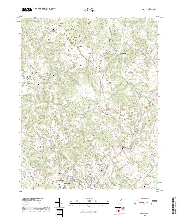
2022 Map of Scottsville
USGS Topo · Published 2022About this map
Scottsville serves as the focal point of this Allen County landscape, situated at the junction of several regional routes like New Glasgow Rd. The town's historical fabric is evident in the Allen County Judicial Center and the Old Scottsville Cem, reflecting its role as a long-standing center of local government and community life. North of the city, the terrain is defined by the winding course of Bays Fork and its tributaries, including W Bays Fork and N-Prong Bays Fork, which cut through the prominent Bays Ridge. Scattered crossroads settlements such as Gainesville, Settle, and Yesse dot the northern reaches, each marked by early landmarks like Greenville Baptist Church Cem and Clifton Baptist Church Cem. The map documents a rural network of family-named roads and remote burial grounds, including the Heeter - Griggs Graveyard, preserving the genealogy of this Kentucky upland.
Find a feature on this map
117 named features on this map. Tap any name to fly to it.
Don’t see what you’re looking for? This feature index may not catch every label — zoom into the map to look around manually.
Map Details
Editions of this 2022 Scottsville Map
This is the sole edition of this map. No revisions or reprints were ever made.
Other maps of this area

1921 · Bowling Green
USGS Topo · 1:62,500

1923 · Bowling Green
USGS Topo · 1:62,500

1926 · Scottsville
USGS Topo · 1:62,500

1928 · Adolphus
USGS Topo · 1:48,000

1931 · Lafayette
USGS Topo · 1:62,500

1931 · Adolphus
USGS Topo · 1:62,500

1942 · Gallatin
USGS Topo · 1:100,000

1954 · Austin
USGS Topo · 1:24,000

1954 · Petroleum
USGS Topo · 1:24,000
1954 · Polkville
USGS Topo · 1:24,000