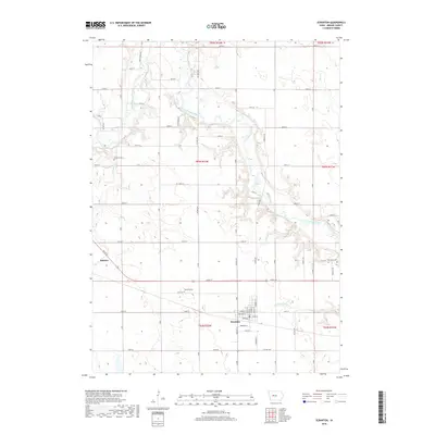
2018 Map of Scranton
USGS Topo · Published 2018About this map
Scranton serves as the primary hub of activity in this Greene County landscape, situated where the town grid intersects local routes like Co Hwy E53. The agricultural character of the region is defined by a dense network of sectional roads and the meandering path of the North Raccoon River, which cuts diagonally across the northern and eastern sections of the quadrangle. Smaller tributaries like Otter Cr and Short Cr, along with engineered solutions like Drainage Ditch 171, manage the water across these fertile plains.
Find a feature on this map
65 named features on this map. Tap any name to fly to it.
Don’t see what you’re looking for? This feature index may not catch every label — zoom into the map to look around manually.
Map Details
Editions of this 2018 Scranton Map
This is the sole edition of this map. No revisions or reprints were ever made.
Other maps of this area

1954 · Bagley
USGS Topo · 1:62,500

1954 · Omaha
USGS Topo · 1:250,000

1954 · Fort Dodge
USGS Topo · 1:250,000

1957 · Omaha
USGS Topo · 1:250,000

1957 · Fort Dodge
USGS Topo · 1:250,000

1958 · Omaha
USGS Topo · 1:250,000

1958 · Fort Dodge
USGS Topo · 1:250,000

1962 · Jefferson
USGS Topo · 1:62,500

1971 · Coon Rapids NE
USGS Topo · 1:24,000

1971 · Coon Rapids North
USGS Topo · 1:24,000