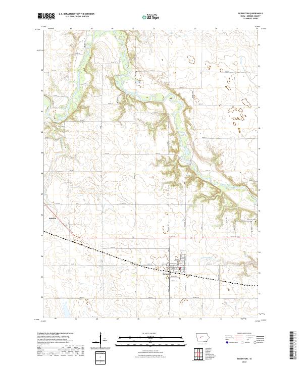
2022 Map of Scranton
USGS Topo · Published 2022About this map
The North Raccoon River winds through the heart of this Greene County landscape, creating a serpentine corridor of riparian terrain amidst the surrounding grid of agricultural roads. The town of Scranton serves as the primary municipal center, organized along a traditional street grid south of the river. Further west, the smaller settlement of Ralston sits near the western boundary, connected to the larger regional network by a series of numbered section-line roads.
Find a feature on this map
99 named features on this map. Tap any name to fly to it.
Don’t see what you’re looking for? This feature index may not catch every label — zoom into the map to look around manually.
Map Details
Editions of this 2022 Scranton Map
This is the sole edition of this map. No revisions or reprints were ever made.
Other maps of this area

1954 · Bagley
USGS Topo · 1:62,500

1954 · Omaha
USGS Topo · 1:250,000

1954 · Fort Dodge
USGS Topo · 1:250,000

1957 · Omaha
USGS Topo · 1:250,000

1957 · Fort Dodge
USGS Topo · 1:250,000

1958 · Omaha
USGS Topo · 1:250,000

1958 · Fort Dodge
USGS Topo · 1:250,000

1962 · Jefferson
USGS Topo · 1:62,500

1971 · Coon Rapids NE
USGS Topo · 1:24,000

1971 · Coon Rapids North
USGS Topo · 1:24,000