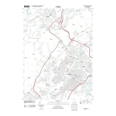
2010 Map of Scranton
USGS Topo · Published 2010About this map
The industrial legacy of the Lackawanna Valley is etched across this landscape, where dozens of anthracite-era mine shafts like the Marvine Shaft and Leggetts Creek Shaft sit adjacent to established neighborhoods. While Scranton and Dunmore form the dense urban core, the map reveals the complex infrastructure of a city built on coal, showing the Clark Tunnel and a dense network of transit lines including the Scranton Expy.
Find a feature on this map
144 named features on this map. Tap any name to fly to it.
Don’t see what you’re looking for? This feature index may not catch every label — zoom into the map to look around manually.
Map Details
Editions of this 2010 Scranton Map
This is the sole edition of this map. No revisions or reprints were ever made.
Other maps of this area

1889 · Scranton
USGS Topo · 1:62,500

1891 · Scranton
USGS Topo · 1:62,500

1892 · Dundaff
USGS Topo · 1:62,500

1893 · Pittston
USGS Topo · 1:62,500

1893 · Scranton
USGS Topo · 1:62,500

1943 · Scranton
USGS Topo · 1:125,000

1946 · Tunkhannock
USGS Topo · 1:62,500

1946 · Dalton
USGS Topo · 1:24,000
1946 · Avoca
USGS Topo · 1:24,000

1946 · Olyphant
USGS Topo · 1:24,000