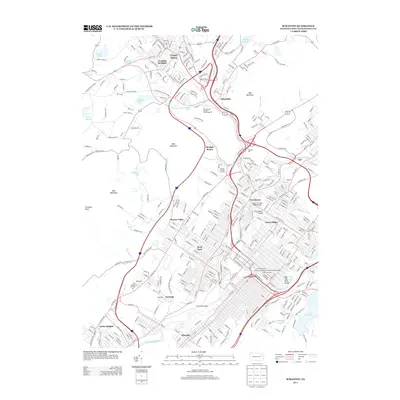
2013 Map of Scranton
USGS Topo · Published 2013About this map
The Lackawanna River corridor defines the industrial and urban backbone of this Northeastern Pennsylvania landscape, flowing through a series of densely settled neighborhoods including Hyde Park and Providence. The region's infrastructure is marked by numerous crossings and historical engineering markers, such as the D and H Green Ridge Bridge, the Pump Works Bridge, and the underground presence of the Clark Tunnel. These features indicate a complex subterranean and surface network built to support the heavy rail and mining activities of the Anthracite Coal Region.
Find a feature on this map
363 named features on this map. Tap any name to fly to it.
Don’t see what you’re looking for? This feature index may not catch every label — zoom into the map to look around manually.
Map Details
Editions of this 2013 Scranton Map
This is the sole edition of this map. No revisions or reprints were ever made.
Other maps of this area

1889 · Scranton
USGS Topo · 1:62,500

1891 · Scranton
USGS Topo · 1:62,500

1892 · Dundaff
USGS Topo · 1:62,500

1893 · Pittston
USGS Topo · 1:62,500

1893 · Scranton
USGS Topo · 1:62,500

1943 · Scranton
USGS Topo · 1:125,000

1946 · Tunkhannock
USGS Topo · 1:62,500

1946 · Dalton
USGS Topo · 1:24,000
1946 · Avoca
USGS Topo · 1:24,000

1946 · Olyphant
USGS Topo · 1:24,000