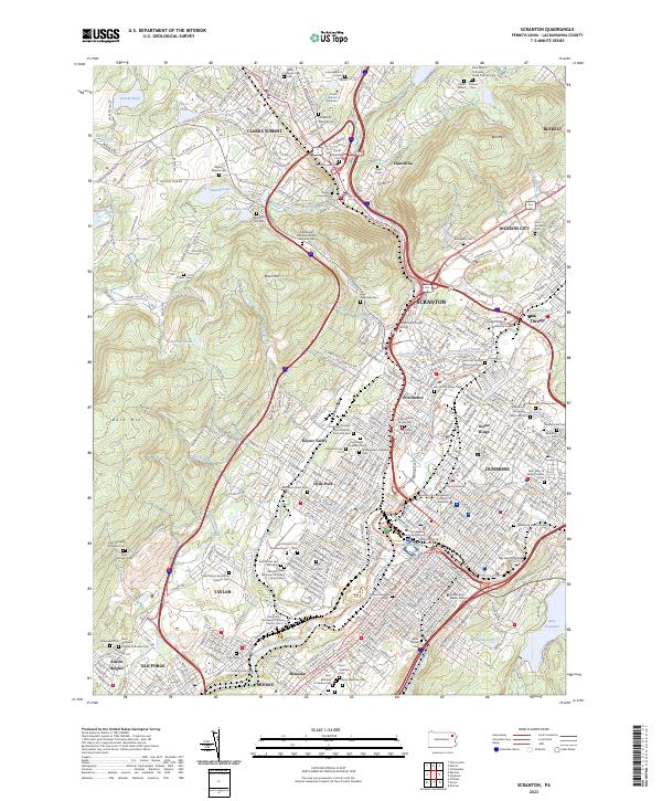
2023 Map of Scranton
USGS Topo · Published 2023About this map
The Lackawanna River corridor defines this landscape, where the industrial legacy of anthracite country meets the institutional growth of a modern regional hub. Modern infrastructure is visible through the Lackawanna River Heritage Trail, while the Steamtown National Historic Site preserves the area's profound railroading identity. The urban core is flanked by significant educational and civic centers, including the University of Scranton, Marywood University, and the Lackawanna County Courthouse.
Find a feature on this map
104 named features on this map. Tap any name to fly to it.
Don’t see what you’re looking for? This feature index may not catch every label — zoom into the map to look around manually.
Map Details
Editions of this 2023 Scranton Map
This is the sole edition of this map. No revisions or reprints were ever made.
Other maps of this area

1889 · Scranton
USGS Topo · 1:62,500

1891 · Scranton
USGS Topo · 1:62,500

1892 · Dundaff
USGS Topo · 1:62,500

1893 · Pittston
USGS Topo · 1:62,500

1893 · Scranton
USGS Topo · 1:62,500

1943 · Scranton
USGS Topo · 1:125,000

1946 · Tunkhannock
USGS Topo · 1:62,500

1946 · Dalton
USGS Topo · 1:24,000
1946 · Avoca
USGS Topo · 1:24,000

1946 · Olyphant
USGS Topo · 1:24,000