
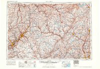
1965 Map of Scranton
USGS Topo · Published 1965About this map
Scranton and Wilkes-Barre anchor the coal-rich Wyoming Valley in this mid-1960s perspective of the Mid-Atlantic highlands. The landscape is defined by the heavy infrastructure of the anthracite era, with the Erie Lackawanna RR, Lehigh Valley RR, and Central RR of New Jersey tracing the complex topography of the Moosic Mountains and the Lackawanna River. To the east, the map reveals a shift toward resource management and defense, featuring the massive Ashokan Reservoir and Neversink Reservoir that serve distant urban centers, alongside the Tobyhanna Military Reservation.
Find a feature on this map
93 named features on this map. Tap any name to fly to it.
Don’t see what you’re looking for? This feature index may not catch every label — zoom into the map to look around manually.
Map Details
Editions of this 1965 Scranton Map
2 editions found
Other maps of this area

1888 · Franklin
USGS Topo · 1:62,500

1888 · Morristown
USGS Topo · 1:62,500

1888 · Hackettstown
USGS Topo · 1:62,500

1888 · Lake Hopatcong
USGS Topo · 1:62,500

1888 · Paterson
USGS Topo · 1:62,500

1889 · Scranton
USGS Topo · 1:62,500

1889 · Hazleton
USGS Topo · 1:62,500

1891 · Greenwood Lake
USGS Topo · 1:62,500

1891 · Ramapo
USGS Topo · 1:62,500

1891 · Wilkesbarre
USGS Topo · 1:62,500