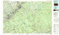
1986 Map of Scranton
USGS Topo · Published 1988About this map
Scranton and Wilkes-Barre anchor the industrial and urban core of the Wyoming Valley in this mid-1980s look at Northeast Pennsylvania. The landscape reveals the dense settlement patterns of the anthracite region, where the Lackawanna River and Susquehanna River corridors are lined with historic borough names like Pittston, Nanticoke, and Carbondale. Evidence of the region's heavy industrial heritage is visible at the Marvine Colliery and Huber Breaker, while institutional growth is marked by the University of Scranton and Wilkes College.
Find a feature on this map
126 named features on this map. Tap any name to fly to it.
Don’t see what you’re looking for? This feature index may not catch every label — zoom into the map to look around manually.
Map Details
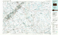
Editions of this 1986 Scranton Map
2 editions found
Other maps of this area

1888 · Hackettstown
USGS Topo · 1:62,500

1889 · Scranton
USGS Topo · 1:62,500

1889 · Hazleton
USGS Topo · 1:62,500

1891 · Wilkesbarre
USGS Topo · 1:62,500

1891 · Hazleton
USGS Topo · 1:62,500

1891 · Wallpack
USGS Topo · 1:62,500

1891 · Scranton
USGS Topo · 1:62,500

1891 · Delaware Water Gap
USGS Topo · 1:62,500

1891 · Harveys Lake
USGS Topo · 1:62,500

1892 · Honesdale
USGS Topo · 1:62,500