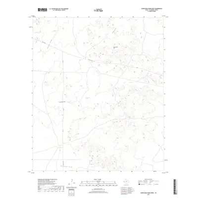
2019 Map of Screw Bean Draw West
USGS Topo · Published 2019About this map
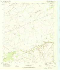
Screw Bean Hills anchor this high desert landscape in Culberson County, where the dry drainage systems of the Trans-Pecos dominate the terrain. A network of ephemeral watercourses including Kimbell Draw, China Draw, and Screw Bean Draw reveals the complex hydrology of this arid region. These draws are punctuated by rare water sources like Toy Springs and Cottonwood Springs, which historically served as critical landmarks for travelers in the West Texas scrub. The infrastructure of the late 2010s is represented by the intersection of Ranch Rd 652 and several Farm to Market roads, such as FM 3541 and FM 2185. Near the southern edge, Horseshoe Draw and Ranch Rd 2185 provide further context for the remote ranching and transit patterns that continue to shape this corner of the state.
Find a feature on this map
12 named features on this map. Tap any name to fly to it.
Don’t see what you’re looking for? This feature index may not catch every label — zoom into the map to look around manually.
Map Details
Editions of this 2019 Screw Bean Draw West Map
This is the sole edition of this map. No revisions or reprints were ever made.
Other maps of this area

1954 · Van Horn
USGS Topo · 1:250,000

1958 · Van Horn
USGS Topo · 1:250,000

1973 · Owl Hills
USGS Topo · 1:24,000

1973 · Seven L Peak NE
USGS Topo · 1:24,000

1973 · Rustler Hills
USGS Topo · 1:24,000

1973 · Screw Bean Draw West
USGS Topo · 1:24,000
1973 · Derrick Draw
USGS Topo · 1:24,000
1973 · Screw Bean Draw NE
USGS Topo · 1:24,000
1973 · Castile Hill
USGS Topo · 1:24,000
1973 · Outlaw Spring
USGS Topo · 1:24,000