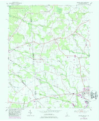
1955 Map of Seaford West
USGS Topo · Published 1987About this map
Seaford stands as a primary hub on this Delmarva Peninsula map, positioned at the intersection of rail lines and highways near the Maryland Delaware border. The landscape is defined by an intricate network of drainage ditches and branches, such as Trivitts Ditch and Butler Mill Branch, which supported the region's agricultural productivity and early milling operations like Craigs Mill. The distribution of Grain Storage Elevators near the railroad tracks underscores the importance of the grain trade to the local economy during the mid-20th century.
Find a feature on this map
47 named features on this map. Tap any name to fly to it.
Don’t see what you’re looking for? This feature index may not catch every label — zoom into the map to look around manually.
Map Details
Editions of this 1955 Seaford West Map
2 editions found
Other maps of this area

1905 · Denton
USGS Topo · 1:62,500

1905 · Hurlock
USGS Topo · 1:62,500

1915 · Seaford
USGS Topo · 1:62,500

1918 · Harrington
USGS Topo · 1:62,500

1944 · Federalsburg
USGS Topo · 1:31,680

1944 · Seaford
USGS Topo · 1:62,500

1944 · Hobbs
USGS Topo · 1:31,680
1944 · Rhodesdale
USGS Topo · 1:31,680
1944 · Harrington
USGS Topo · 1:62,500

1946 · Salisbury
USGS Topo · 1:250,000