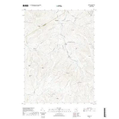
2019 Map of Seager
USGS Topo · Published 2019About this map
Dry Brook flows through a landscape defined by sharp ridges and deep hollows along the border of Delaware and Ulster counties. The small settlement of Seager serves as a focal point in the valley, where the historic Forge Covered Bridge and Tappan Bridge span the local waterways. High-elevation features like Balsam Lake Mtn and Graham Mtn dominate the horizon, while smaller gaps such as Sids Notch provide natural passage through the terrain. Evidence of local heritage is found in the Baker Cem and Lake Hill Cem, which sit near the northern hamlet of Mapledale. The southern portion of the area is heavily defined by the Beaver Kill Range, feeding into the famous Beaver Kill trout waters and Balsam Lake.
Find a feature on this map
66 named features on this map. Tap any name to fly to it.
Don’t see what you’re looking for? This feature index may not catch every label — zoom into the map to look around manually.
Map Details
Editions of this 2019 Seager Map
This is the sole edition of this map. No revisions or reprints were ever made.
Other maps of this area

1900 · Phoenicia
USGS Topo · 1:62,500

1901 · Margaretville
USGS Topo · 1:62,500

1903 · Phoenicia
USGS Topo · 1:62,500

1903 · Slide Mountain
USGS Topo · 1:62,500

1904 · Margaretville
USGS Topo · 1:62,500

1905 · Slide Mountain
USGS Topo · 1:62,500

1910 · Neversink
USGS Topo · 1:62,500

1942 · Neversink
USGS Topo · 1:62,500

1943 · Peekamoose Mountain
USGS Topo · 1:31,680

1943 · Monticello
USGS Topo · 1:125,000