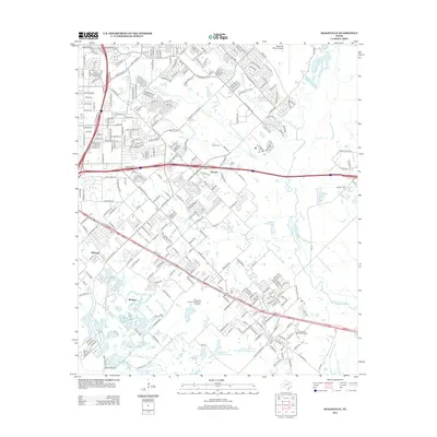
2012 Map of Seagoville
USGS Topo · Published 2012About this map
The E Fork Trinity River winds through the eastern edge of this landscape, anchoring a terrain defined by its complex hydrology and suburban expansion. The settlements of Lawson, Kleberg, and Bobwyn represent the historic residential nodes of the area, while the sprawling Seagoville Federal Correctional Institution serves as a major regional landmark. Water management is a central theme, evidenced by the Soil Conservation Service Site 5 Reservoir and Soil Conservation Service Site 6 Reservoir, alongside natural features like Lawrence Lake and Parsons Slough. For those researching local heritage, several burial grounds are preserved across the quadrangle, including the Sand Branch Cem, Lee Cem, and Rose Lawn Memorial Gardens. The map also captures the critical transportation infrastructure connecting these communities, most notably the C F Hawn Fwy and Interstate 20.
Find a feature on this map
35 named features on this map. Tap any name to fly to it.
Don’t see what you’re looking for? This feature index may not catch every label — zoom into the map to look around manually.
Map Details
Editions of this 2012 Seagoville Map
This is the sole edition of this map. No revisions or reprints were ever made.
Other maps of this area

1891 · Dallas
USGS Topo · 1:125,000

1893 · Dallas
USGS Topo · 1:125,000

1919 · Royse City
USGS Topo · 1:62,500

1954 · Dallas
USGS Topo · 1:250,000

1956 · Kaufman
USGS Topo · 1:62,500

1957 · White Rock Lake
USGS Topo · 1:24,000

1958 · Dallas
USGS Topo · 1:250,000

1958 · Hutchins
USGS Topo · 1:24,000

1958 · White Rock Lake
USGS Topo · 1:24,000

1959 · Mesquite
USGS Topo · 1:24,000