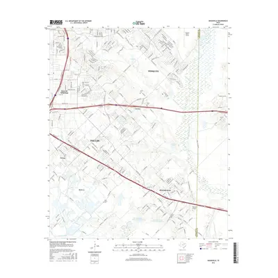
2016 Map of Seagoville
USGS Topo · Published 2016About this map
The E Fork Trinity River floodplain dominates the eastern portion of this landscape, creating a distinct natural boundary between the expanding suburban developments of Dallas and the more open terrain of Kaufman County. To the west, the residential street networks of Balch Springs and Seagoville show the dense growth of the mid-2010s, yet the map preserves numerous historical markers of the area's rural past. A significant number of small family and community burial grounds, such as Potter Cem and Lumley Cem, are scattered throughout the Lawson and Bobwyn areas. The map also captures the complex water management systems of the region, featuring the Soil Conservation Service Site 5 Reservoir and the winding course of Hickory Cr as it makes its way toward Parsons Slough, illustrating the transition from urban infrastructure to protected bottomlands.
Find a feature on this map
224 named features on this map. Tap any name to fly to it.
Don’t see what you’re looking for? This feature index may not catch every label — zoom into the map to look around manually.
Map Details
Editions of this 2016 Seagoville Map
This is the sole edition of this map. No revisions or reprints were ever made.
Other maps of this area

1891 · Dallas
USGS Topo · 1:125,000

1893 · Dallas
USGS Topo · 1:125,000

1919 · Royse City
USGS Topo · 1:62,500

1954 · Dallas
USGS Topo · 1:250,000

1956 · Kaufman
USGS Topo · 1:62,500

1957 · White Rock Lake
USGS Topo · 1:24,000

1958 · Dallas
USGS Topo · 1:250,000

1958 · Hutchins
USGS Topo · 1:24,000

1958 · White Rock Lake
USGS Topo · 1:24,000

1959 · Mesquite
USGS Topo · 1:24,000