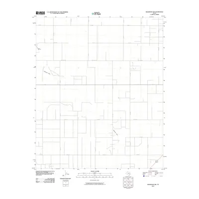
2010 Map of Seagraves NW
USGS Topo · Published 2010About this map
Plains Gas Plant stands as a prominent industrial landmark in this section of Gaines County, reflecting the region's energy-based infrastructure. The landscape is defined by the ephemeral path of McKenzie Draw, which winds through a strictly surveyed grid of rural roads and section lines. The transport network here is highly organized, anchored by FM 1939 and a system of county roads such as Co Rd 211 and Co Rd 203 that facilitate movement through the open country. Local industrial activity is further evidenced by Light Plant Rd, which connects the utility infrastructure to the surrounding agricultural and industrial zones. This map provides a detailed view of the high plains of West Texas as it appeared in the early 21st century, showing the intersection of natural drainage features with human-made industrial and transportation developments.
Find a feature on this map
23 named features on this map. Tap any name to fly to it.
Don’t see what you’re looking for? This feature index may not catch every label — zoom into the map to look around manually.
Map Details
Editions of this 2010 Seagraves NW Map
This is the sole edition of this map. No revisions or reprints were ever made.
Other maps of this area

1954 · Hobbs
USGS Topo · 1:250,000

1954 · Brownfield
USGS Topo · 1:250,000

1958 · Brownfield
USGS Topo · 1:250,000

1958 · Hobbs
USGS Topo · 1:250,000

1962 · Brownfield
USGS Topo · 1:250,000

1970 · Seagraves SW
USGS Topo · 1:24,000

1970 · Seagraves SE
USGS Topo · 1:24,000

1970 · Seagraves
USGS Topo · 1:24,000
1970 · Tokio SE
USGS Topo · 1:24,000

1970 · Pleasant Hill
USGS Topo · 1:24,000