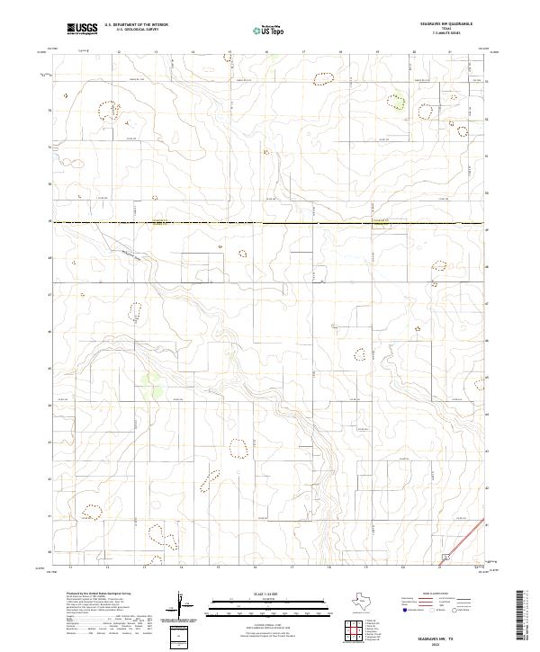
2022 Map of Seagraves NW
USGS Topo · Published 2022About this map
McKenzie Draw carves a path through the southern High Plains along the border of Yoakum and Gaines Counties, illustrating the quiet agricultural and ranching layout of this West Texas region. This 2022 survey captures a landscape organized by a rigorous grid of section lines and county roads, where traditional ranching routes like Ranch Rd 1939 and FM 1939 provide the primary connectivity across the scrub and grassland. The sparse distribution of man-made structures highlights the rural character of the area, where the terrain is dominated by the subtle drainage of the draw and scattered ephemeral wetlands. Local transit is defined by long, straight stretches of road such as Co Rd 390 and Co Rd 211, marking the boundaries of large land holdings and providing essential access for modern agricultural operations in this corner of the state.
Find a feature on this map
27 named features on this map. Tap any name to fly to it.
Don’t see what you’re looking for? This feature index may not catch every label — zoom into the map to look around manually.
Map Details
Editions of this 2022 Seagraves NW Map
This is the sole edition of this map. No revisions or reprints were ever made.
Other maps of this area

1954 · Hobbs
USGS Topo · 1:250,000

1954 · Brownfield
USGS Topo · 1:250,000

1958 · Brownfield
USGS Topo · 1:250,000

1958 · Hobbs
USGS Topo · 1:250,000

1962 · Brownfield
USGS Topo · 1:250,000

1970 · Seagraves SW
USGS Topo · 1:24,000

1970 · Seagraves SE
USGS Topo · 1:24,000

1970 · Seagraves
USGS Topo · 1:24,000
1970 · Tokio SE
USGS Topo · 1:24,000

1970 · Pleasant Hill
USGS Topo · 1:24,000