
1970 Map of Seagraves NW
USGS Topo · Published 1974About this map
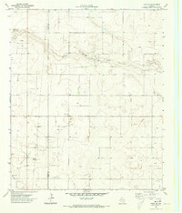
The O D C Oil Field and the Plains Gas Plant dominate this West Texas landscape, showing a region defined by mid-century petroleum development. Straddling the boundary of Yoakum Co and Gaines Co, the survey reveals a dense network of wells and pipelines that crisscross the arid plains. The most significant natural drainage feature is McKenzie Draw, which cuts a winding path through the northern and central sections of the quadrangle. Industrial activity is further evidenced by several Gravel Pits located near the draw. Large ranching or oil interest tracts like Reeves are also marked, providing a clear picture of land use and resource extraction during the early 1970s.
Find a feature on this map
8 named features on this map. Tap any name to fly to it.
Don’t see what you’re looking for? This feature index may not catch every label — zoom into the map to look around manually.
Map Details
Editions of this 1970 Seagraves NW Map
This is the sole edition of this map. No revisions or reprints were ever made.
Other maps of this area

1954 · Hobbs
USGS Topo · 1:250,000

1954 · Brownfield
USGS Topo · 1:250,000

1958 · Brownfield
USGS Topo · 1:250,000

1958 · Hobbs
USGS Topo · 1:250,000

1962 · Brownfield
USGS Topo · 1:250,000

1970 · Seagraves SW
USGS Topo · 1:24,000

1970 · Seagraves SE
USGS Topo · 1:24,000

1970 · Seagraves
USGS Topo · 1:24,000
1970 · Tokio SE
USGS Topo · 1:24,000

1970 · Pleasant Hill
USGS Topo · 1:24,000