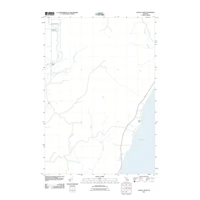
2011 Map of Seagull Point
USGS Topo · Published 2011About this map
The Cedar River and Bark River systems dominate this coastal landscape along the western shore of Lake Michigan. This 2011 survey illustrates the rural character of the region, where numerous small tributaries like Degraves Creek and Brill Brook drain into larger watercourses. For genealogists and local historians, the northern section of the map is particularly significant, showing the proximity of the Seventh Day Adventist Church and the Seventh Day Adventist Cemetery near the banks of Advent Creek. Transport across this terrain is facilitated by localized crossings such as Jam Dam Bridge and McCarty Bridge. The shoreline is punctuated by Seagull Point, a distinct geographic feature where Olson Creek meets the lake, providing a clear picture of the hydrologic network that has long shaped the settlement patterns of this Michigan coastline.
Find a feature on this map
14 named features on this map. Tap any name to fly to it.
Don’t see what you’re looking for? This feature index may not catch every label — zoom into the map to look around manually.
Map Details
Editions of this 2011 Seagull Point Map
This is the sole edition of this map. No revisions or reprints were ever made.
Other maps of this area

1932 · Bark River NE
USGS Topo · 1:31,680

1954 · Escanaba
USGS Topo · 1:250,000

1957 · Escanaba
USGS Topo · 1:250,000

1958 · Escanaba
USGS Topo · 1:250,000

1958 · Escanaba
USGS Topo · 1:62,500

1960 · Ellison Bay
USGS Topo · 1:62,500

1963 · Bark River
USGS Topo · 1:62,500

1963 · Cedar River
USGS Topo · 1:62,500

1981 · Marinette
USGS Topo · 1:100,000

1982 · Escanaba
USGS Topo · 1:100,000
Featured Places
- Ford River Township, MI
- Gourley Township, MI
- Bark River Township, MI
- Cedarville Township, MI
- Delta County, MI