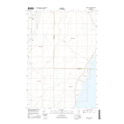
2014 Map of Seagull Point
USGS Topo · Published 2014About this map
The Lake Michigan shoreline dominates the eastern edge of this landscape, characterized by the prominent landform of Seagull Point and the mouth of Olson Cr. Further inland, the boundary between Menominee and Delta counties divides a terrain defined by a network of drainage systems, including the Cedar River, Bark River, and the curiously named Lake Thirtysix. The presence of the Seventh Day Adventist Church Cem near the northern boundary provides a specific point of interest for genealogists and local historians tracking early community roots in the area.
Find a feature on this map
37 named features on this map. Tap any name to fly to it.
Don’t see what you’re looking for? This feature index may not catch every label — zoom into the map to look around manually.
Map Details
Editions of this 2014 Seagull Point Map
This is the sole edition of this map. No revisions or reprints were ever made.
Other maps of this area

1932 · Bark River NE
USGS Topo · 1:31,680

1954 · Escanaba
USGS Topo · 1:250,000

1957 · Escanaba
USGS Topo · 1:250,000

1958 · Escanaba
USGS Topo · 1:250,000

1958 · Escanaba
USGS Topo · 1:62,500

1960 · Ellison Bay
USGS Topo · 1:62,500

1963 · Bark River
USGS Topo · 1:62,500

1963 · Cedar River
USGS Topo · 1:62,500

1981 · Marinette
USGS Topo · 1:100,000

1982 · Escanaba
USGS Topo · 1:100,000
Featured Places
- Ford River Township, MI
- Gourley Township, MI
- Bark River Township, MI
- Cedarville Township, MI
- Delta County, MI