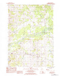
1984 Map of Sears
USGS Topo · Published 1984About this map
The Muskegon River winds through this central Michigan landscape, defining the character of several townships including Osceola and Sylvan. In the mid-1980s, the settlement of Sears remains a focal point along the Chesapeake and Ohio railroad corridor, which cuts east-to-west across the lower half of the map. The area is marked by a distinctive grid of numbered rural roads, ranging from Fivemile Road to Twelvemile Road, providing a clear structure for researchers tracing family homesteads or property boundaries.
Find a feature on this map
41 named features on this map. Tap any name to fly to it.
Don’t see what you’re looking for? This feature index may not catch every label — zoom into the map to look around manually.
Map Details
Editions of this 1984 Sears Map
This is the sole edition of this map. No revisions or reprints were ever made.
Other maps of this area

1954 · Traverse City
USGS Topo · 1:250,000

1954 · Midland
USGS Topo · 1:250,000

1957 · Cadillac South
USGS Topo · 1:62,500

1957 · Marion
USGS Topo · 1:62,500

1958 · Traverse City
USGS Topo · 1:250,000

1958 · Midland
USGS Topo · 1:250,000

1959 · Midland
USGS Topo · 1:250,000

1959 · Lake
USGS Topo · 1:62,500

1959 · Evart
USGS Topo · 1:62,500

1966 · Midland
USGS Topo · 1:250,000
Featured Places
- Evart Township, MI
- Hartwick Township, MI
- Sylvan Township, MI
- Middle Branch Township, MI
- Osceola Township, MI