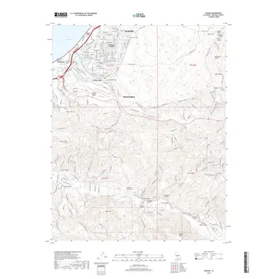
2018 Map of Seaside
USGS Topo · Published 2018About this map
Monterey and its neighboring coastal communities of Sand City and Seaside anchor the northwestern portion of this 2018 survey. The landscape transitions rapidly from the urban grid of Del Monte Heights and the shoreline at Del Monte Beach into a complex system of ridges and canyons. The Monterey Regional Airport occupies a central plateau, while the terrain to the south and east becomes increasingly defined by landmarks such as Saddle Mtn and Snivleys Ridge.
Find a feature on this map
147 named features on this map. Tap any name to fly to it.
Don’t see what you’re looking for? This feature index may not catch every label — zoom into the map to look around manually.
Map Details
Editions of this 2018 Seaside Map
This is the sole edition of this map. No revisions or reprints were ever made.
Other maps of this area

1910 · Salinas
USGS Topo · 1:31,680

1912 · Salinas
USGS Topo · 1:62,500

1913 · Monterey
USGS Topo · 1:62,500

1918 · Point Sur
USGS Topo · 1:62,500

1920 · Jamesburg
USGS Topo · 1:48,000

1921 · Jamesburg
USGS Topo · 1:62,500

1925 · Point Sur
USGS Topo · 1:62,500

1939 · Jamesburg
USGS Topo · 1:62,500

1940 · Salinas
USGS Topo · 1:62,500

1940 · Jamesburg
USGS Topo · 1:62,500