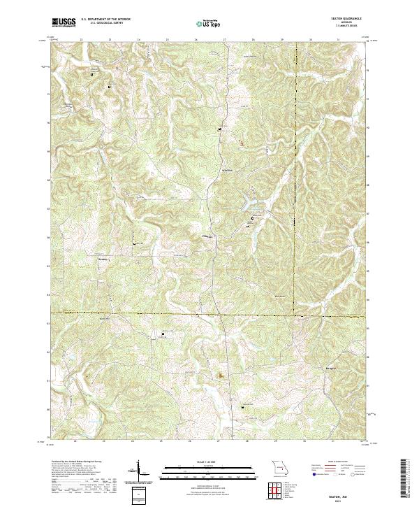
2021 Map of Seaton
USGS Topo · Published 2021About this map
Seaton and the surrounding rural landscape at the intersection of Phelps, Crawford, and Dent Counties are defined by a complex network of Ozark hollows and ridges. This modern survey illustrates a quiet, decentralized settlement pattern centered on family-named landmarks and historic burials. Numerous cemeteries, including the Benton-Hale Cem and Grubb-Andrew Cem, are tucked away in the terrain near drainage systems like Norman Cr and W Fork Benton Cr. The map reveals the persistence of early pioneer naming conventions in features such as Asher Hollow and Normans Hollow, while small settlements like Winkler and Bangert serve as navigational anchors along the winding state highways and county roads. Prominent elevations such as Blue Knob and Wards Hill provide the relief that dictates the course of the local creeks, including the Dry Fork in the southwest corner.
Find a feature on this map
71 named features on this map. Tap any name to fly to it.
Don’t see what you’re looking for? This feature index may not catch every label — zoom into the map to look around manually.
Map Details
Editions of this 2021 Seaton Map
This is the sole edition of this map. No revisions or reprints were ever made.
Other maps of this area

1928 · Meramec Spring
USGS Topo · 1:62,500

1932 · Steelville
USGS Topo · 1:48,000

1933 · Steelville
USGS Topo · 1:62,500

1937 · Steelville
USGS Topo · 1:62,500

1941 · Salem
USGS Topo · 1:62,500

1941 · Stone Hill
USGS Topo · 1:62,500

1945 · Salem
USGS Topo · 1:62,500

1945 · Stone Hill
USGS Topo · 1:62,500

1949 · Rolla
USGS Topo · 1:250,000

1949 · Meramec Spring
USGS Topo · 1:62,500