
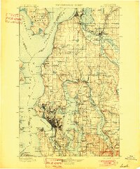
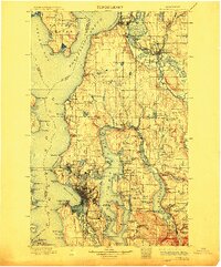
1897 Map of Seattle
USGS Topo · Published 1897About this map
The Seattle waterfront and the surrounding Puget Sound lowlands appear here in a period of rapid expansion, just as the Klondike Gold Rush began to transform the region's economy. The map illustrates a landscape defined by its deep-water access and a burgeoning rail network, including the Great Northern RR and the Northern Pacific RR winding through the valleys. Coastal settlements like Everett and Edmonds are clearly established, while the interior is dotted with early landing sites such as Curtis Landing and Moorland along the eastern shores of Lake Washington.
Find a feature on this map
178 named features on this map. Tap any name to fly to it.
Don’t see what you’re looking for? This feature index may not catch every label — zoom into the map to look around manually.
Map Details
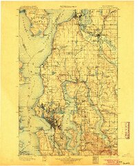
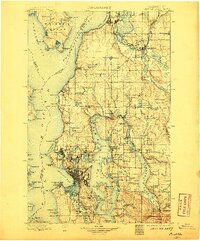
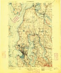
Editions of this 1897 Seattle Map
10 editions found
1897 edition
14.59 x 20.6 inches
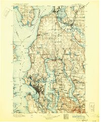
1901 edition
16.56 x 19.94 inches
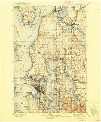
1904 edition
16.55 x 19.92 inches
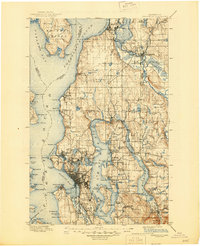
1906 edition
16.58 x 19.93 inches
1909 edition
16.54 x 19.93 inches
1912 edition
16.57 x 19.95 inches

1918 edition
16.54 x 19.88 inches
1930 edition
16.56 x 19.95 inches
1940 edition
16.55 x 19.95 inches
1945 edition
17.1 x 21 inches
Other maps of this area

1894 · Seattle
USGS Topo · 1:62,500

1895 · Snohomish
USGS Topo · 1:125,000

1897 · Tacoma
USGS Topo · 1:125,000

1899 · Stillaguamish
USGS Topo · 1:125,000

1900 · Tacoma
USGS Topo · 1:125,000

1901 · Stilaguamish
USGS Topo · 1:125,000

1908 · Seattle
USGS Topo · 1:62,500

1909 · Seattle Special
USGS Topo · 1:62,500

1911 · Mount Vernon
USGS Topo · 1:125,000

1913 · Cedar Lake
USGS Topo · 1:125,000