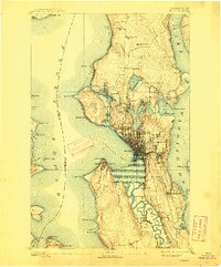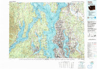
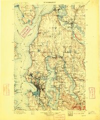
1897 Map of Seattle
USGS Topo · Published 1901About this map
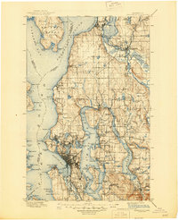
The waters of Possession Sound and Elliott Bay define this turn-of-the-century coastal landscape, where the maritime and railroad economies of Puget Sound were rapidly maturing. The primary urban center of Seattle is depicted before the massive regrading projects of the early 20th century, showing a city tightly bound by its topography near Duwamish Head and Magnolia Bluff. To the north, the industrial waterfront of Everett and the river town of Snohomish are connected by a dense network of rail lines including the Great Northern RR and the Everett & Monte Cristo RR. Smaller settlements like Ballard, Fremont, and Ravenna appear as distinct entities, many of which would later be annexed as the city expanded. The map meticulously documents the transition from densely timbered terrain to organized townships, noting numerous freshwater bodies like Lake Washington and landmarks such as the West Pt. L.H. and the Port Madison Indian Reservation.
Find a feature on this map
184 named features on this map. Tap any name to fly to it.
Don’t see what you’re looking for? This feature index may not catch every label — zoom into the map to look around manually.
Map Details
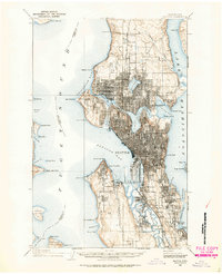
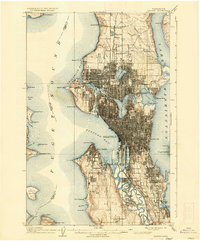
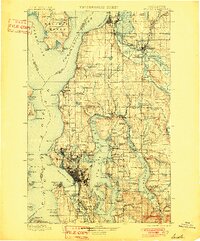
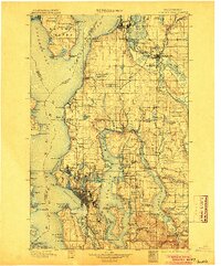
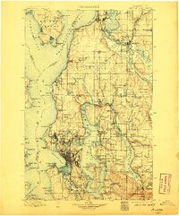
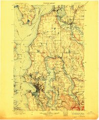
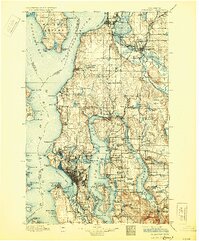
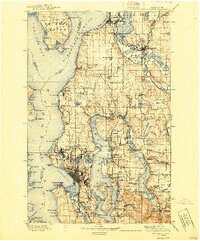
Editions of this 1897 Seattle Map
10 editions found

1897 edition
14.59 x 20.6 inches
1901 edition
16.56 x 19.94 inches
1904 edition
16.55 x 19.92 inches
1906 edition
16.58 x 19.93 inches
1909 edition
16.54 x 19.93 inches
1912 edition
16.57 x 19.95 inches

1918 edition
16.54 x 19.88 inches
1930 edition
16.56 x 19.95 inches
1940 edition
16.55 x 19.95 inches
1945 edition
17.1 x 21 inches
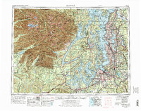
Historical Maps of Seattle Through Time
7 maps found