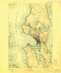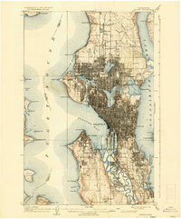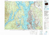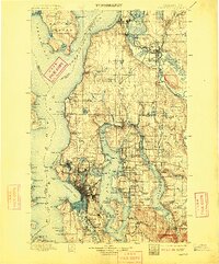
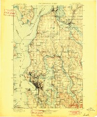
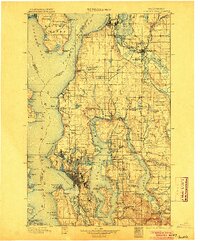
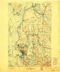
1897 Map of Seattle
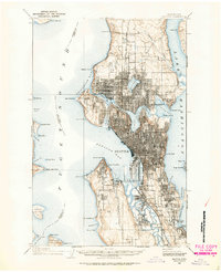
USGS Topo · Published 1909About this map
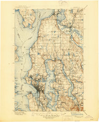
Seattle serves as the focal point of this turn-of-the-century landscape, a period when the city's urban footprint was concentrated around Elliott Bay and the industrial corridors of the Columbia & Puget Sound RR. The map illustrates a region in rapid transition, where early landings like Curtis Landing and Robinson Landing dot the shores of Lake Washington, and the Northern Pacific RR connects emerging timber and trade hubs like Everett and Snohomish. Beyond the growing city core, the geography is defined by maritime points such as Alki Pt. and West Pt., while Mercer Island remains largely undeveloped. The presence of the Fort Madison Indian Reservation on the Kitsap Peninsula side of Possession Sound highlights the complex cultural and political boundaries of the era, while named water bodies like Green Lake and Salmon Bay mark the edges of the expanding metropolitan frontier.
Find a feature on this map
172 named features on this map. Tap any name to fly to it.
Don’t see what you’re looking for? This feature index may not catch every label — zoom into the map to look around manually.
Map Details
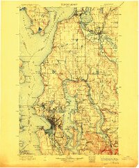
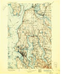
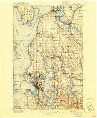
Editions of this 1897 Seattle Map
10 editions found

1897 edition
14.59 x 20.6 inches
1901 edition
16.56 x 19.94 inches
1904 edition
16.55 x 19.92 inches
1906 edition
16.58 x 19.93 inches
1909 edition
16.54 x 19.93 inches
1912 edition
16.57 x 19.95 inches

1918 edition
16.54 x 19.88 inches
1930 edition
16.56 x 19.95 inches
1940 edition
16.55 x 19.95 inches
1945 edition
17.1 x 21 inches
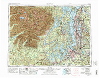
Historical Maps of Seattle Through Time
7 maps found