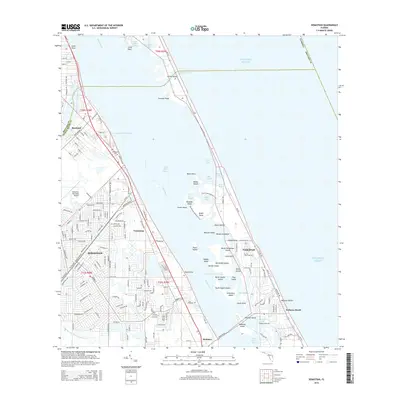
2015 Map of Sebastian
USGS Topo · Published 2015About this map
Indian River Lagoon and the Intracostal Waterway serve as the central focus of this coastal study, separating the mainland settlements of Sebastian, Roseland, and Wabasso from the barrier reef islands. The landscape is defined by an intricate network of islands and sloughs, including Pelican Island, Roseate Island, and Turtle Pen Slough, which highlight the environmental character of the Florida coast before further modernization. Transportation is anchored by the Florida East Coast railway and the historic Old Dixie Hwy, which parallel the shoreline.
Find a feature on this map
171 named features on this map. Tap any name to fly to it.
Don’t see what you’re looking for? This feature index may not catch every label — zoom into the map to look around manually.
Map Details
Editions of this 2015 Sebastian Map
This is the sole edition of this map. No revisions or reprints were ever made.
Other maps of this area

1948 · Riomar
USGS Topo · 1:24,000

1949 · Fellsmere
USGS Topo · 1:24,000

1949 · Sebastian NW
USGS Topo · 1:24,000

1949 · Vero Beach
USGS Topo · 1:24,000

1949 · Sebastian
USGS Topo · 1:24,000

1949 · Grant
USGS Topo · 1:24,000

1950 · Riomar
USGS Topo · 1:24,000

1950 · Vero Beach
USGS Topo · 1:24,000

1951 · Sebastian NW
USGS Topo · 1:24,000

1951 · Fellsmere
USGS Topo · 1:24,000