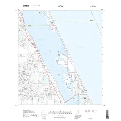
2018 Map of Sebastian
USGS Topo · Published 2018About this map
The Indian River Lagoon and Intracoastal Waterway dominate this coastal landscape, separating the mainland communities of Sebastian, Roseland, and Cummings from the barrier islands. The settlement pattern follows the shoreline, with dense residential development in Sebastian extending westward toward the Sebastian Municipal Airport. Along the riverbanks, historic local landmarks like the Sebastian Municipal Cem are preserved amidst modern expansion. Across the water on Orchid Island, the map shows the protected expanse of Pelican Island, the nation's first National Wildlife Refuge. This 2018 survey captures the interface between these natural conservation areas and the growing coastal towns of North Beach and Windsor, illustrating how the region's geography is defined by the shallow waters of the Saint Sebastian River and numerous named islets like Roosevelt Island and Snake Island.
Find a feature on this map
226 named features on this map. Tap any name to fly to it.
Don’t see what you’re looking for? This feature index may not catch every label — zoom into the map to look around manually.
Map Details
Editions of this 2018 Sebastian Map
This is the sole edition of this map. No revisions or reprints were ever made.
Other maps of this area

1948 · Riomar
USGS Topo · 1:24,000

1949 · Fellsmere
USGS Topo · 1:24,000

1949 · Sebastian NW
USGS Topo · 1:24,000

1949 · Vero Beach
USGS Topo · 1:24,000

1949 · Sebastian
USGS Topo · 1:24,000

1949 · Grant
USGS Topo · 1:24,000

1950 · Riomar
USGS Topo · 1:24,000

1950 · Vero Beach
USGS Topo · 1:24,000

1951 · Sebastian NW
USGS Topo · 1:24,000

1951 · Fellsmere
USGS Topo · 1:24,000