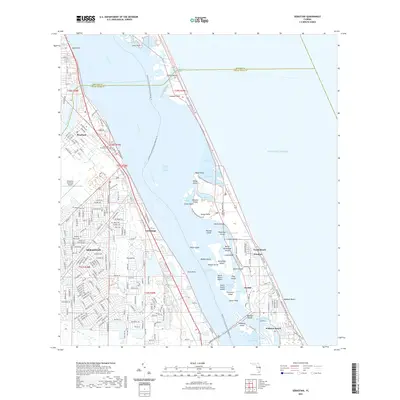
2021 Map of Sebastian
USGS Topo · Published 2021About this map
The Indian River Lagoon dominates this coastal landscape, separating the mainland communities of Sebastian and Roseland from the barrier islands. On the western shore, the Sebastian Municipal Cem and Sebastian Municipal Airport serve as major landmarks within the organized street grids of the growing city. The waterway is punctuated by numerous named islands, including the notable Pelican Island, while the Intracoastal Waterway provides a protected passage for transit.
Find a feature on this map
98 named features on this map. Tap any name to fly to it.
Don’t see what you’re looking for? This feature index may not catch every label — zoom into the map to look around manually.
Map Details
Editions of this 2021 Sebastian Map
This is the sole edition of this map. No revisions or reprints were ever made.
Other maps of this area

1948 · Riomar
USGS Topo · 1:24,000

1949 · Fellsmere
USGS Topo · 1:24,000

1949 · Sebastian NW
USGS Topo · 1:24,000

1949 · Vero Beach
USGS Topo · 1:24,000

1949 · Sebastian
USGS Topo · 1:24,000

1949 · Grant
USGS Topo · 1:24,000

1950 · Riomar
USGS Topo · 1:24,000

1950 · Vero Beach
USGS Topo · 1:24,000

1951 · Sebastian NW
USGS Topo · 1:24,000

1951 · Fellsmere
USGS Topo · 1:24,000