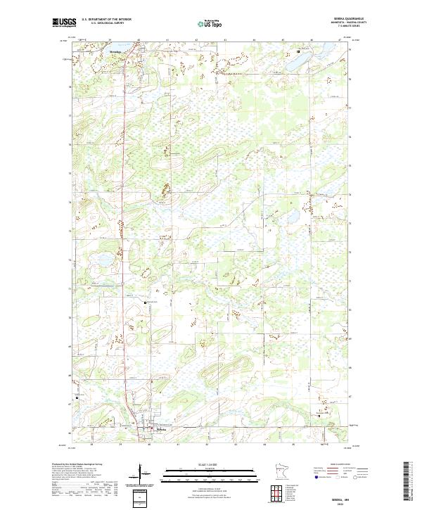
2022 Map of Sebeka
USGS Topo · Published 2022About this map
Sebeka and Menahga serve as the primary hubs in this Wadena County landscape, where the local economy and settlement patterns are dictated by an intricate network of waterways. The Redeye River flows through the southern portion of the township, joined by its tributaries including Hay Cr and Kitten Cr. To the north, the Cat River winds through terrain dotted with wetlands, while the southern tip of Spirit Lake reaches into the town of Menahga. For genealogists, the map is particularly valuable for its precise location of several rural burial grounds, including Jim Cook Cem, Mantyla Cem, and Evergreen Cem. The grid of county roads, such as Co Rd 147 and Co Rd 13, connects these small communities and family landmarks, tracing the agricultural and timber-linked heritage of central Minnesota.
Find a feature on this map
65 named features on this map. Tap any name to fly to it.
Don’t see what you’re looking for? This feature index may not catch every label — zoom into the map to look around manually.
Map Details
Editions of this 2022 Sebeka Map
This is the sole edition of this map. No revisions or reprints were ever made.
Other maps of this area

1953 · Brainerd
USGS Topo · 1:250,000

1957 · Brainerd
USGS Topo · 1:250,000

1958 · Brainerd
USGS Topo · 1:250,000

1965 · Brainerd
USGS Topo · 1:250,000

1969 · Sebeka SW
USGS Topo · 1:24,000

1969 · Menahga
USGS Topo · 1:24,000

1969 · Park Rapids SW
USGS Topo · 1:24,000

1969 · Sebeka
USGS Topo · 1:24,000

1969 · Sebeka NW
USGS Topo · 1:24,000
1969 · Blue Grass
USGS Topo · 1:24,000