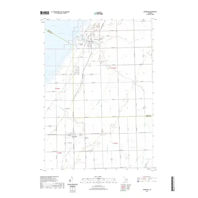
2019 Map of Sebewaing
USGS Topo · Published 2019About this map
Sebewaing and Unionville anchor this 2019 survey of Michigan's Thumb region, where the land meets the eastern reaches of Saginaw Bay. The landscape is defined by an intricate network of agricultural drainage systems, including the Wiscoggin Drain, State Drain, and Columbian Drain, which feed toward Lake Huron. This water management infrastructure reflects the area's deep-rooted farming heritage, supporting a grid of rural roads such as Oeschger Rd and Sebewaing Rd. For those researching local family history, several prominent burial grounds are documented, including Saint Johns Lutheran Cem, the Moravian Cem, and Columbia Township Cem. The Sebewaing River cuts through the northern settlement, while the Sebewaing Airport serves as a modern landmark on the outskirts of the village.
Find a feature on this map
92 named features on this map. Tap any name to fly to it.
Don’t see what you’re looking for? This feature index may not catch every label — zoom into the map to look around manually.
Map Details
Editions of this 2019 Sebewaing Map
This is the sole edition of this map. No revisions or reprints were ever made.
Other maps of this area

1954 · Flint
USGS Topo · 1:250,000

1958 · Flint
USGS Topo · 1:250,000

1963 · Fish Point
USGS Topo · 1:24,000

1963 · Fairgrove
USGS Topo · 1:24,000

1963 · Ellington
USGS Topo · 1:24,000

1963 · Owendale
USGS Topo · 1:24,000

1963 · Colling
USGS Topo · 1:24,000

1963 · Sebewaing
USGS Topo · 1:24,000

1970 · Bay Port West
USGS Topo · 1:24,000

1970 · Bay Port East
USGS Topo · 1:24,000