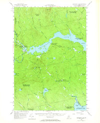
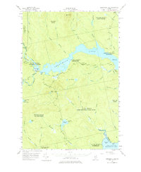
1954 Map of Seboomook Lake
USGS Topo · Published 1970About this map
Pittston Farm stands as the primary hub of human activity within this mid-century expanse of the Maine North Woods, situated where the South Branch and West Branch meet. The landscape is dominated by the extensive waters of Seboomook Lake and Canada Falls Lake, which are regulated by infrastructure like the Canada Falls Dam. This era of the timberlands is marked by a complex system of private roads threading through numbered townships such as Pittston Academy and Plymouth. Significant elevations like Seboomook Mtn and Sevenmile Hill overlook a dense network of waterways including Socatean Stream and Tomhegan Stream, which flow toward the northwestern reaches of Moosehead Lake at Socatean Bay. The map provides a detailed view of the region's hydrological management and isolated settlements before modern development altered these remote interior townships.
Find a feature on this map
47 named features on this map. Tap any name to fly to it.
Don’t see what you’re looking for? This feature index may not catch every label — zoom into the map to look around manually.
Map Details
Editions of this 1954 Seboomook Lake Map
6 editions found

Other maps of this area

1920 · Moosehead Lake
USGS Topo · 1:62,500

1921 · Brassua Lake
USGS Topo · 1:62,500

1922 · Moosehead Lake
USGS Topo · 1:62,500

1922 · Long Pond
USGS Topo · 1:62,500

1923 · Brassua Lake
USGS Topo · 1:62,500

1924 · Long Pond
USGS Topo · 1:62,500

1930 · Moosehead Lake
USGS Topo · 1:62,500

1944 · Brassua Lake
USGS Topo · 1:62,500

1944 · Moosehead Lake
USGS Topo · 1:62,500

1944 · Long Pond
USGS Topo · 1:62,500
Featured Places
- Tomhegan Township, ME
- Elm Stream Township, ME
- West Middlesex Canal Grant Township, ME
- Seboomook Township, ME
- Comstock Township, ME