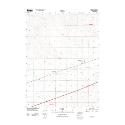
2013 Map of Sedgwick
USGS Topo · Published 2013About this map
Sedgwick is the primary settlement on this northeastern Colorado landscape, positioned along the northern bank of the S Platte River. This region is defined by a sophisticated water management system necessary for High Plains agriculture, featuring the Highline Canal, Settlers Ditch, and Peterson Ditch which parallel the river's course. These man-made waterways emphasize the transition from the dry uplands, marked by features like Sedgwick Draw and Sand Draw, to the irrigated bottomlands near the Cottonwood Creek confluence. The town site itself is structured around Railroad St and the local Post Office, reflecting its origins as a transport and service hub for the surrounding ranching and farming community. Notable for genealogists, the Sedgwick Cem sits north of the main townsite, while the small location of Dorsey appears further west along Us-138 E.
Find a feature on this map
36 named features on this map. Tap any name to fly to it.
Don’t see what you’re looking for? This feature index may not catch every label — zoom into the map to look around manually.
Map Details
Editions of this 2013 Sedgwick Map
This is the sole edition of this map. No revisions or reprints were ever made.
Other maps of this area

1899 · Sidney
USGS Topo · 1:125,000

1900 · Chappell
USGS Topo · 1:125,000

1952 · Julesburg SW
USGS Topo · 1:24,000

1952 · Marks Butte
USGS Topo · 1:24,000

1953 · Ovid
USGS Topo · 1:24,000

1953 · Tamarack Ranch
USGS Topo · 1:24,000

1953 · Julesburg Reservoir
USGS Topo · 1:24,000

1953 · Sedgwick
USGS Topo · 1:24,000

1954 · Sterling
USGS Topo · 1:250,000

1954 · Scottsbluff
USGS Topo · 1:250,000