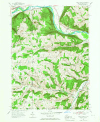
1953 Map of Seeley Creek
USGS Topo · Published 1955About this map
Chemung River valley life and the hills of the New York-Pennsylvania borderlands define this mid-century landscape. The topography is dominated by massive elevations like Steege Hill and Cleveland Hill, while rural life clusters along watercourses such as Seeley Creek and Mudlick Creek. The presence of several localized educational sites, including Hittown Sch and Kelly Hill Sch, points to a dispersed community structure before school consolidation. Near the river, the infrastructure of the Erie RR and a large Power Plant contrast with the spiritual seclusion of the Mt Savior Monastery. Cultural landmarks of the early fifties, such as a Drive-in Theater and Glider Field, reflect the era's recreational habits near the larger settlements of East Corning and Webb Mills.
Find a feature on this map
60 named features on this map. Tap any name to fly to it.
Don’t see what you’re looking for? This feature index may not catch every label — zoom into the map to look around manually.
Map Details
Editions of this 1953 Seeley Creek Map
2 editions found
Other maps of this area

1895 · Elmira
USGS Topo · 1:62,500

1900 · Tioga
USGS Topo · 1:62,500

1902 · Tioga
USGS Topo · 1:62,500

1905 · Watkins Glen
USGS Topo · 1:125,000

1914 · Corning
USGS Topo · 1:62,500

1931 · Troy
USGS Topo · 1:48,000

1938 · Troy
USGS Topo · 1:62,500

1944 · Corning
USGS Topo · 1:62,500

1950 · Elmira
USGS Topo · 1:250,000
1953 · Corning
USGS Topo · 1:24,000