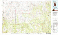
1981 Map of Seep Ridge
USGS Topo · Published 1982About this map
The Uintah and Ouray Indian Reservation dominates this 1980s landscape, where the high plateaus of the Uinta Basin meet the deep incisions of the Green River. This mapping period captures a region defined by its energy and defense history, featuring the expansive Naval Oil Shale Reserve No 2 and numerous landing strips and survey marks like Uslm 12. The terrain is a complex network of benches and draws, including Wild Horse Bench and the prominent Seep Ridge.
Find a feature on this map
97 named features on this map. Tap any name to fly to it.
Don’t see what you’re looking for? This feature index may not catch every label — zoom into the map to look around manually.
Map Details
Editions of this 1981 Seep Ridge Map
2 editions found
Other maps of this area

1885 · East Tavaputs
USGS Topo · 1:250,000

1885 · Ashley
USGS Topo · 1:250,000

1885 · Uinta
USGS Topo · 1:250,000

1886 · Price River
USGS Topo · 1:250,000

1896 · Price River
USGS Topo · 1:250,000

1907 · Rangely
USGS Topo · 1:125,000

1907 · Jensen
USGS Topo · 1:125,000

1910 · Jensen
USGS Topo · 1:125,000

1910 · Rangely
USGS Topo · 1:125,000

1917 · Vernal
USGS Topo · 1:125,000