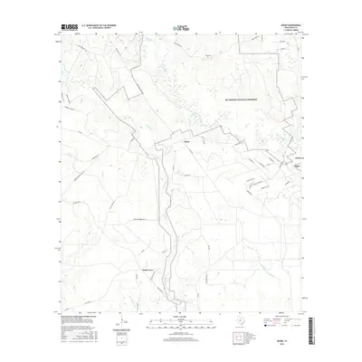
2016 Map of Segno
USGS Topo · Published 2016About this map
Segno and Holly Grove sit at the heart of this East Texas landscape, where the dense woodlands of the Big Thicket National Preserve meet local timber and ranching roads. The area is defined by a dendritic network of waterways, including Big Sandy Cr and Menard Cr, which flow toward the southern reaches of Little Pine Island Bayou. This terrain is crisscrossed by specialized routes such as Segno Fire Ln North, indicating the critical infrastructure required for forest management in Polk County. Genealogists will find the Davis Cem near the northern boundary, providing a specific anchor for local family histories. The presence of varied road names like Menard Chapel Rd and Summerall RD suggests the enduring footprints of early communities and rural landholdings in this part of the Piney Woods.
Find a feature on this map
53 named features on this map. Tap any name to fly to it.
Don’t see what you’re looking for? This feature index may not catch every label — zoom into the map to look around manually.
Map Details
Editions of this 2016 Segno Map
This is the sole edition of this map. No revisions or reprints were ever made.
Other maps of this area

1943 · Liberty
USGS Topo · 1:125,000

1954 · Beaumont
USGS Topo · 1:250,000

1955 · Saratoga
USGS Topo · 1:62,500

1955 · Rayburn
USGS Topo · 1:62,500

1957 · Beaumont
USGS Topo · 1:250,000

1958 · Livingston
USGS Topo · 1:62,500

1958 · Segno
USGS Topo · 1:62,500

1984 · Segno
USGS Topo · 1:24,000

1984 · Soda
USGS Topo · 1:24,000

1984 · Beaumont
USGS Topo · 1:250,000