
1926 Map of Segovia 2-c
USGS Topo · Published 1926About this map
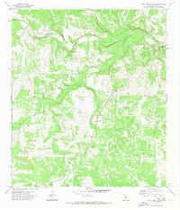
The South Llano River carves a deep path through this portion of the Texas Hill Country, defining the landscape of the mid-1920s. Centered around the remote settlement of Telegraph, the terrain is marked by a complex network of draws and creeks, including Little Paint Creek and Salina Creek, which feed into the main river channel. This survey, conducted by W.B. Brewer for the State of Texas Board of Water Engineers, highlights the critical water sources of the era, most notably the Seven Hundred Springs located near the boundary between Kimble and Edwards Counties. Local civic life is anchored by rural landmarks such as Evergreen School and Paint Rock School, while the Junction Road serves as the primary artery for travel through this dissected limestone plateau. The presence of these specific schools and named springs provides essential spatial data for genealogists and local historians tracing the early twentieth-century development of the western Edwards Plateau.
Find a feature on this map
13 named features on this map. Tap any name to fly to it.
Don’t see what you’re looking for? This feature index may not catch every label — zoom into the map to look around manually.
Map Details
Editions of this 1926 Segovia 2-c Map
This is the sole edition of this map. No revisions or reprints were ever made.
Other maps of this area

1893 · Rock Springs
USGS Topo · 1:125,000

1932 · Junction
USGS Topo · 1:62,500

1954 · Llano
USGS Topo · 1:250,000

1954 · Sonora
USGS Topo · 1:250,000

1955 · Llano
USGS Topo · 1:250,000

1956 · Llano
USGS Topo · 1:250,000

1958 · Sonora
USGS Topo · 1:250,000

1962 · Hill Ranch
USGS Topo · 1:24,000

1962 · Roosevelt
USGS Topo · 1:24,000
1971 · Paint Rock Spring
USGS Topo · 1:24,000