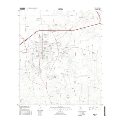
2016 Map of Seguin
USGS Topo · Published 2016About this map
The Guadalupe River carves a winding path through this central Texas corridor, creating a series of impoundments including Lake Placid, Max Starcke Reservoir, and Meadow Lake. The city of Seguin serves as the regional anchor, characterized by a dense grid of residential streets and institutional landmarks like Texas Lutheran Univ and Max Starcke Park. Beyond the city limits, the landscape transitions into a mix of agricultural flats and riparian zones, where numerous small tributaries like Geronimo Cr and Cottonwood Cr feed the primary river system.
Find a feature on this map
211 named features on this map. Tap any name to fly to it.
Don’t see what you’re looking for? This feature index may not catch every label — zoom into the map to look around manually.
Map Details
Editions of this 2016 Seguin Map
This is the sole edition of this map. No revisions or reprints were ever made.
Other maps of this area

1911 · San Marcos
USGS Topo · 1:125,000

1919 · San Marcos
USGS Topo · 1:125,000

1920 · Smiley
USGS Topo · 1:125,000

1924 · New Braunfels No 4
USGS Topo · 1:48,000

1924 · San Marcos 3-c
USGS Topo · 1:48,000

1924 · San Marcos 3-d
USGS Topo · 1:48,000

1925 · New Braunfels No 1
USGS Topo · 1:48,000

1927 · New Braunfels
USGS Topo · 1:62,500

1930 · Seguin
USGS Topo · 1:62,500

1942 · Dewville
USGS Topo · 1:62,500