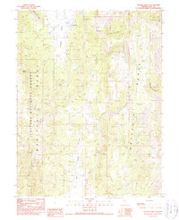
1990 Map of Segura Ranch
USGS Topo · Published 1990About this map
Segura Ranch sits at the northern end of Antelope Valley, serving as a primary point of human activity in this high-elevation basin within the Toiyabe National Forest. The 1990 survey captures a landscape defined by water scarcity and relief, where vital sources like Segura Spring, Cabin Spring, and Applebush Hill Spring (Corral) dictate the patterns of ranching and movement. The geography is bounded by the Monitor Range to the west and the Antelope Range to the east, with White Rock Creek and Meadow Creek draining the high slopes. Evidence of mineral exploration appears as Prospects scattered across the ridges, while a network of 4wd tracks connects the ranch to distant valley floors like Dry Valley. The presence of several springs and a Stock Pond highlights the intensive management of this arid environment for grazing and survival.
Find a feature on this map
23 named features on this map. Tap any name to fly to it.
Don’t see what you’re looking for? This feature index may not catch every label — zoom into the map to look around manually.
Map Details
Editions of this 1990 Segura Ranch Map
This is the sole edition of this map. No revisions or reprints were ever made.
Other maps of this area

1926 · Roberts Mountains
USGS Topo · 1:250,000

1929 · Roberts Mountains
USGS Topo · 1:250,000

1955 · Millett
USGS Topo · 1:250,000

1956 · Cockalorum Wash
USGS Topo · 1:62,500

1956 · Horse Heaven Mtn
USGS Topo · 1:62,500

1956 · Tonopah
USGS Topo · 1:250,000

1959 · Tonopah
USGS Topo · 1:250,000

1959 · Millett
USGS Topo · 1:250,000

1962 · Tonopah
USGS Topo · 1:250,000

1968 · Pritchards Station
USGS Topo · 1:62,500