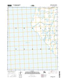
2016 Map of Selawik C-6 NW
USGS Topo · Published 2016About this map
Hotham Inlet dominates this coastal landscape in the Northwest Arctic, where complex waterways weave through a low-lying marshland environment. The map details the intricate hydrography of the region, specifically focusing on the Lewis Rich Channel and the Olikatuk Channel as they navigate the shoreline of the inlet. This area is defined by its seasonal shift between land and water, with numerous unnamed ponds and wetlands surrounding these primary channels. This 2016 survey documents the shifting aquatic boundaries of the Alaska coast, providing a clear record of the maritime topography within the boundaries of T16N R15W and T15N R14W. Researchers of Arctic geography will find the exact contours of these coastal channels particularly useful for understanding the drainage patterns of the Selawik region.
Find a feature on this map
9 named features on this map. Tap any name to fly to it.
Don’t see what you’re looking for? This feature index may not catch every label — zoom into the map to look around manually.
Map Details
Editions of this 2016 Selawik C-6 NW Map
This is the sole edition of this map. No revisions or reprints were ever made.
Other maps of this area

1951 · Selawik
USGS Topo · 1:250,000

1951 · Kotzebue
USGS Topo · 1:250,000

1951 · Kotzebue D-1
USGS Topo · 1:63,360

1951 · Selawik C-6
USGS Topo · 1:63,360

1951 · Selawik D-6
USGS Topo · 1:63,360
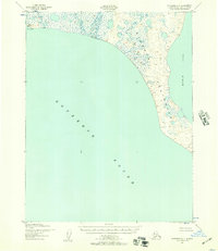
1951 · Kotzebue C-1
USGS Topo · 1:63,360

1952 · Selawik D-6
USGS Topo · 1:63,360

1957 · Selawik
USGS Topo · 1:250,000

1958 · Kotzebue
USGS Topo · 1:250,000

1964 · Kotzebue
USGS Topo · 1:250,000