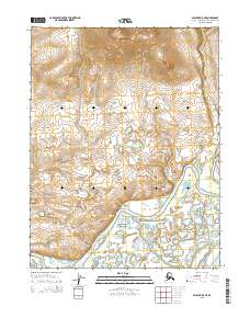
2015 Map of Selawik D-5 NE
USGS Topo · Published 2015About this map
The Kiana Hills rise prominently in the northern reaches of this Northwest Arctic landscape, providing a stark topographical contrast to the low-lying wetlands and complex waterways below. The southern portion of the terrain is defined by the wandering path of the Melvin Channel, a significant distributary that winds through a mosaic of small lakes and marshy ground typical of the Selawik region. This 2015 survey reveals the intricate hydrography of the Alaskan interior, where the relationship between the elevated hills and the saturated floodplains dictates the natural movement of water across the territory. While devoid of named settlements or man-made structures, the map meticulously documents the environmental transition from upland slopes to the riverine networks of the arctic tundra.
Find a feature on this map
8 named features on this map. Tap any name to fly to it.
Don’t see what you’re looking for? This feature index may not catch every label — zoom into the map to look around manually.
Map Details
Editions of this 2015 Selawik D-5 NE Map
This is the sole edition of this map. No revisions or reprints were ever made.
Other maps of this area

1951 · Baird Mountains
USGS Topo · 1:250,000

1951 · Selawik
USGS Topo · 1:250,000

1955 · Selawik D-4
USGS Topo · 1:63,360

1955 · Selawik D-5
USGS Topo · 1:63,360
1955 · Baird Mountains A-5
USGS Topo · 1:63,360

1955 · Baird Mountains A-4
USGS Topo · 1:63,360

1956 · Baird Mountains
USGS Topo · 1:250,000

1957 · Selawik
USGS Topo · 1:250,000

1965 · Baird Mountains
USGS Topo · 1:250,000
2014 · Baird Mountains A-5 SE
USGS Topo · 1:25,000