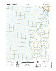
2014 Map of Selawik D-6 SW
USGS Topo · Published 2014About this map
Hotham Inlet dominates this coastal landscape in the Northwest Arctic, revealing the intricate water systems of the Alaskan interior as they met the sea in 2014. The terrain is defined by the labyrinthine delta of the Selawik River, where the Melvin Channel and Riley Channel carve through the low-lying wetlands. These waterways are essential features for understanding the traditional subsistence patterns and seasonal navigation of the region. The map provides a clear look at the t17n r14w, t16n r15w, and t16n r14w township and range lines, which overlay a complex of small lakes and tidal flats typical of this remote northern coastline.
Find a feature on this map
6 named features on this map. Tap any name to fly to it.
Don’t see what you’re looking for? This feature index may not catch every label — zoom into the map to look around manually.
Map Details
Editions of this 2014 Selawik D-6 SW Map
This is the sole edition of this map. No revisions or reprints were ever made.
Other maps of this area

1951 · Selawik
USGS Topo · 1:250,000

1951 · Kotzebue
USGS Topo · 1:250,000

1951 · Kotzebue D-1
USGS Topo · 1:63,360

1951 · Selawik C-6
USGS Topo · 1:63,360

1951 · Selawik D-6
USGS Topo · 1:63,360
1951 · Kotzebue C-1
USGS Topo · 1:63,360

1952 · Selawik D-6
USGS Topo · 1:63,360

1957 · Selawik
USGS Topo · 1:250,000

1958 · Kotzebue
USGS Topo · 1:250,000

1964 · Kotzebue
USGS Topo · 1:250,000