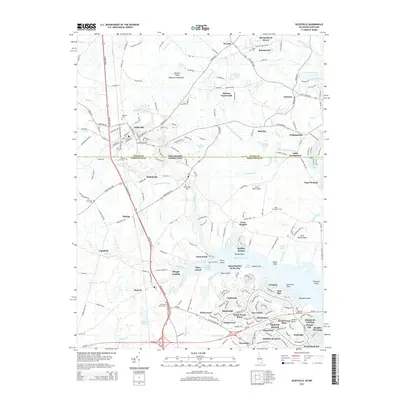
2014 Map of Selbyville
USGS Topo · Published 2014About this map
The Saint Martin River and its intricate network of tributaries define this coastal section of the Eastern Shore Delmarva Peninsula. Located along the border of Sussex and Worcester Counties, the landscape transitions from the agricultural hinterlands of Bishopville and Selbyville to the residential developments of Ocean Pines. Genealogists will find several burial grounds of interest, including the Old Saint Martins Cem and Wilgus Cem near Roxana. The southern half of the map illustrates the modern suburban layout of neighborhoods like Tanglewood and South Ocean Pines, while the northern portion retains more rural characteristics around Hudson Crossroads and Bunting. Transportation is anchored by the Maryland and Delaware RR and Dupont Blvd, while water access is provided through numerous prongs and branches such as Slab Bridge Prong and Birch Branch.
Find a feature on this map
223 named features on this map. Tap any name to fly to it.
Don’t see what you’re looking for? This feature index may not catch every label — zoom into the map to look around manually.
Map Details
Editions of this 2014 Selbyville Map
This is the sole edition of this map. No revisions or reprints were ever made.
Other maps of this area

1901 · Ocean City
USGS Topo · 1:62,500

1902 · Pittsville
USGS Topo · 1:62,500

1917 · Millsboro
USGS Topo · 1:62,500

1918 · Rehoboth
USGS Topo · 1:62,500

1938 · Millsboro
USGS Topo · 1:62,500

1938 · Rehoboth
USGS Topo · 1:62,500

1942 · Ocean City
USGS Topo · 1:62,500

1942 · Ninepin
USGS Topo · 1:24,000

1942 · Ocean City
USGS Topo · 1:24,000

1942 · Whaleysville
USGS Topo · 1:24,000