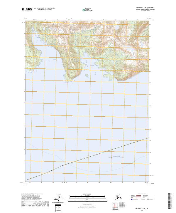
2024 Map of Seldovia A-4 NE
USGS Topo · Published 2024About this map
The Alaska Maritime National Wildlife Refuge dominates the landscape of the southern Kenai Peninsula, where the land meets the Gulf of Alaska in a series of deeply carved inlets. This 2024 map documents the complex shoreline of Qikutulig Bay and Tonglaalek Bay, areas characterized by dramatic elevation changes and tidal interfaces. In the open water to the south, Gore Rock serves as a lone navigational landmark in an otherwise immense marine expanse. The absence of roads or permanent settlements highlights the protected status of the refuge, emphasizing the preservation of this remote coastal ecosystem in its current state.
Find a feature on this map
9 named features on this map. Tap any name to fly to it.
Don’t see what you’re looking for? This feature index may not catch every label — zoom into the map to look around manually.
Map Details
Editions of this 2024 Seldovia A-4 NE Map
This is the sole edition of this map. No revisions or reprints were ever made.
Other maps of this area

1951 · Seldovia
USGS Topo · 1:250,000

1951 · Seldovia A-3
USGS Topo · 1:63,360

1951 · Seldovia B-4
USGS Topo · 1:63,360

1951 · Seldovia B-3
USGS Topo · 1:63,360

1951 · Seldovia A-4
USGS Topo · 1:63,360

1952 · Seldovia A-3
USGS Topo · 1:63,360

1952 · Seldovia B-3
USGS Topo · 1:63,360

1953 · Seldovia B-4
USGS Topo · 1:63,360
1953 · Seldovia A-4
USGS Topo · 1:63,360

1963 · Seldovia
USGS Topo · 1:250,000