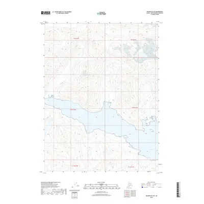
2018 Map of Seldovia B-4 SE
USGS Topo · Published 2018About this map
Port Dick dominates the southern landscape of this coastal Kenai Peninsula region, carving a deep inlet into the high terrain. The shoreline topography is marked by steep elevation changes, with the coastal waters set against a backdrop of inland peaks and glacial valleys. This 2018 survey by the U.S. Geological Survey details the complex hydrology and undeveloped nature of this Alaskan wilderness, where the land remains largely defined by its natural drainage patterns and the heavy influence of the surrounding marine environment. The map provides a clear look at the intricate township and range divisions, including t10s r12w, which organize this otherwise remote and unpopulated stretch of the peninsula.
Find a feature on this map
7 named features on this map. Tap any name to fly to it.
Don’t see what you’re looking for? This feature index may not catch every label — zoom into the map to look around manually.
Map Details
Editions of this 2018 Seldovia B-4 SE Map
This is the sole edition of this map. No revisions or reprints were ever made.
Other maps of this area

1951 · Seldovia
USGS Topo · 1:250,000

1951 · Seldovia A-3
USGS Topo · 1:63,360

1951 · Seldovia B-4
USGS Topo · 1:63,360

1951 · Seldovia B-3
USGS Topo · 1:63,360

1951 · Seldovia A-4
USGS Topo · 1:63,360

1952 · Seldovia A-3
USGS Topo · 1:63,360

1952 · Seldovia B-3
USGS Topo · 1:63,360

1953 · Seldovia B-4
USGS Topo · 1:63,360
1953 · Seldovia A-4
USGS Topo · 1:63,360

1963 · Seldovia
USGS Topo · 1:250,000