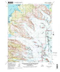
1951 Map of Seldovia C-3
USGS Topo · Published 1986About this map
Kachemak Bay dominates the northwestern landscape of this Kenai Peninsula study, where tidal waters meet a coastline defined by glacial retreat. In the early 1950s, the terrain south of the bay was characterized by the massive ice fields of Grewingk Glacier and Dixon Glacier, which flowed toward the coastal lowlands near Mallard Bay and Aurora Spit. The map documents a sparsely settled wilderness where human presence is marked only by isolated cabins along the shoreline and at Bear Cove. Significant portions of the land are dedicated to conservation, including the Kenai Fjords National Monument and Kachemak Bay State Park. The intricate drainage patterns of the Martin River and Battle Creek provide a detailed look at the hydrology feeding into the larger bay before late-century environmental shifts further altered these icy landscapes.
Find a feature on this map
27 named features on this map. Tap any name to fly to it.
Don’t see what you’re looking for? This feature index may not catch every label — zoom into the map to look around manually.
Map Details
Editions of this 1951 Seldovia C-3 Map
4 editions found

Other maps of this area

1948 · Seldovia C-4
USGS Topo · 1:63,360

1949 · Seldovia C-4
USGS Topo · 1:62,500

1949 · Seldovia D-4
USGS Topo · 1:63,360

1950 · Seldovia D-2
USGS Topo · 1:63,360

1951 · Seldovia D-4
USGS Topo · 1:63,360

1951 · Seldovia
USGS Topo · 1:250,000

1951 · Seldovia D-3
USGS Topo · 1:63,360

1951 · Seldovia B-4
USGS Topo · 1:63,360

1951 · Seldovia B-2
USGS Topo · 1:63,360

1951 · Seldovia B-3
USGS Topo · 1:63,360