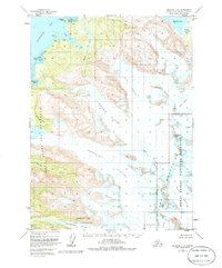
1951 Map of Seldovia C-3
USGS Topo · Published 1986About this map
Grewingk Glacier and Portlock Glacier dominate this mid-century topographic survey of the Kenai Mountains. Flowing from the interior ice fields toward the coast, these massive glaciers carve out the drainage basins for Humpy Creek and Halibut Creek. Along the coastline of Kachemak Bay, the map documents several small clusters of Cabins and a lone Cabin near Bear Cove, indicating seasonal or remote outposts within the rugged shoreline of Kachemak Bay State Park.
Find a feature on this map
26 named features on this map. Tap any name to fly to it.
Don’t see what you’re looking for? This feature index may not catch every label — zoom into the map to look around manually.
Map Details
Editions of this 1951 Seldovia C-3 Map
4 editions found

Other maps of this area

1948 · Seldovia C-4
USGS Topo · 1:63,360

1949 · Seldovia C-4
USGS Topo · 1:62,500

1949 · Seldovia D-4
USGS Topo · 1:63,360

1950 · Seldovia D-2
USGS Topo · 1:63,360

1951 · Seldovia D-4
USGS Topo · 1:63,360

1951 · Seldovia
USGS Topo · 1:250,000

1951 · Seldovia D-3
USGS Topo · 1:63,360

1951 · Seldovia B-4
USGS Topo · 1:63,360

1951 · Seldovia B-2
USGS Topo · 1:63,360

1951 · Seldovia B-3
USGS Topo · 1:63,360