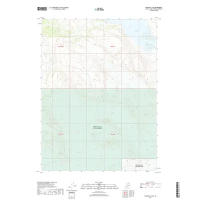
2017 Map of Seldovia C-3 NE
USGS Topo · Published 2017About this map
Kenai National Wildlife Refuge and Kenai Fjords National Park meet in this high-altitude landscape on the Kenai Peninsula. The terrain is defined by massive ice fields and active glacial systems, including the southward-flowing Nuka Glacier and the Portlock Glacier. These frozen features are separated by high ridges that channel meltwater into drainage systems like Battle Cr, which feeds into the wetlands surrounding Bradley Lake in the northeast. The interaction between the Dixon Glacier and the surrounding peaks illustrates the geological forces shaping this subarctic wilderness, where the land remains largely untouched by permanent settlement or infrastructure. The map provides an exacting look at the boundaries between these federal conservation units and the township and range lines of the Public Land Survey System.
Find a feature on this map
11 named features on this map. Tap any name to fly to it.
Don’t see what you’re looking for? This feature index may not catch every label — zoom into the map to look around manually.
Map Details
Editions of this 2017 Seldovia C-3 NE Map
This is the sole edition of this map. No revisions or reprints were ever made.
Other maps of this area

1950 · Seldovia D-2
USGS Topo · 1:63,360

1951 · Seldovia
USGS Topo · 1:250,000

1951 · Seldovia D-3
USGS Topo · 1:63,360

1951 · Seldovia C-3
USGS Topo · 1:63,360

1953 · Seldovia C-3
USGS Topo · 1:63,360

1953 · Seldovia C-2
USGS Topo · 1:63,360

1953 · Seldovia D-2
USGS Topo · 1:63,360
1953 · Seldovia D-3
USGS Topo · 1:63,360

1963 · Seldovia
USGS Topo · 1:250,000
1987 · Seldovia D-3 SW
USGS Topo · 1:25,000