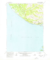
1961 Map of Seldovia C-5
USGS Topo · Published 1978About this map
Homer serves as the terminal hub for the Sterling Highway as it meets the shores of Kachemak Bay in this early 1960s survey. The landscape is defined by the steep elevation gains from the coastline up to Diamond Ridge and Skyline Ridge, where secondary routes like Skyline Drive and Diamond Ridge Road snake across the highlands. Along the northern reaches, the Anchor River winds toward Cook Inlet, supported by the Anchor River Campground and the small settlement at Lilly Lake.
Find a feature on this map
46 named features on this map. Tap any name to fly to it.
Don’t see what you’re looking for? This feature index may not catch every label — zoom into the map to look around manually.
Map Details
Editions of this 1961 Seldovia C-5 Map
4 editions found

Other maps of this area

1946 · Seldovia C-5
USGS Topo · 1:63,360

1946 · Seldovia D-5
USGS Topo · 1:63,360

1948 · Seldovia C-4
USGS Topo · 1:63,360

1949 · Seldovia C-4
USGS Topo · 1:62,500

1949 · Seldovia D-4
USGS Topo · 1:63,360

1951 · Seldovia C-5
USGS Topo · 1:63,360

1951 · Seldovia D-5
USGS Topo · 1:63,360

1951 · Seldovia D-4
USGS Topo · 1:63,360

1951 · Seldovia
USGS Topo · 1:250,000

1951 · Seldovia B-5
USGS Topo · 1:63,360