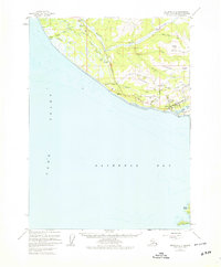
1961 Map of Seldovia C-5
USGS Topo · Published 1979About this map
Homer serves as the focal point for this survey of the southwestern Kenai Peninsula, where the waters of Cook Inlet meet Kachemak Bay. The landscape is defined by its transition from coastal flats to dramatic interior elevations, featuring a network of ridges like Crossman Ridge and Diamond Ridge. The transportation and communication infrastructure of the early 1960s is clearly visible, with the Sterling Highway providing the primary land link and the coastal Seaplane Base and FAA SRA Sta supporting regional maritime and air traffic.
Find a feature on this map
38 named features on this map. Tap any name to fly to it.
Don’t see what you’re looking for? This feature index may not catch every label — zoom into the map to look around manually.
Map Details
Editions of this 1961 Seldovia C-5 Map
4 editions found

Other maps of this area

1946 · Seldovia C-5
USGS Topo · 1:63,360

1946 · Seldovia D-5
USGS Topo · 1:63,360

1948 · Seldovia C-4
USGS Topo · 1:63,360

1949 · Seldovia C-4
USGS Topo · 1:62,500

1949 · Seldovia D-4
USGS Topo · 1:63,360

1951 · Seldovia C-5
USGS Topo · 1:63,360

1951 · Seldovia D-5
USGS Topo · 1:63,360

1951 · Seldovia D-4
USGS Topo · 1:63,360

1951 · Seldovia
USGS Topo · 1:250,000

1951 · Seldovia B-5
USGS Topo · 1:63,360